Medieval Itineraries: Romwegkarte
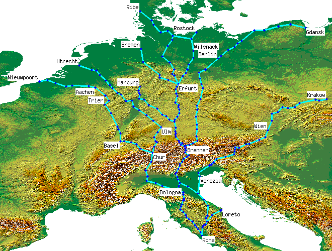
The Romwegkarte, Map of Ways to Rome, was a map produced by Erhard Etzlaub of Nürnberg to help pilgrims from Germany find the way to Rome for the Jubilee Year of 1500. The full title given at the top is Das ist der Rom-Weg von meylen zu meylen mit puncten verzeychnet von eyner stat zu der andern durch deutzsche landt [these are the ways to Rome from one town to another through German territory with points drawn mile for mile], in other words, it is to scale, with each dot on each route representing, not the line of the road, but 1 German Mile (7.4km).
An expanded version of all roads in German territories was published a year later in 1501, Das sein dy lantstrassen durch das Romisch reych von einem Königreich zu dem anderen die an Tewsche land stoßen von meilen zu meilen mit puncten verzeichnet [these are the roads through the Roman Empire from one kingdom to the next for those which border German countries with points drawn mile for mile].
In common with other maps before Mercator, south is at the top and north at the bottom.
More details
spreadsheet | detailed map (226 placemarks)External resources
- The original was in colour, but a b&w reproduction is at the Niedersächsische Staats- und Universitätsbibliothek in Göttingen
- The German section of the 1501 map is available on the Mecklenburg cartography history pages at Rostock university